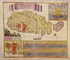

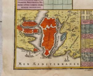
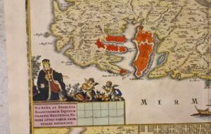

An 18th century copper engraved map of the Maltese islands decorated with the coats of arms of the various Grand Masters who presided over Malta and Gozo. Circa 1730. Engraved surface measures 49.5 cm by 57 cm approximately.
The map is entitled Melite, vulgo Malta cum vicinis Goza, quae olim Gaulos, et Comino insulis and is further decorated with an inset of the map of the grand harbour and its cities and a dramatical scene representing the vanquishing of the Turkish onslaught with the help of the Virgin Mother.


Reviews
There are no reviews yet.